The James Hutton Institute
This page is no longer updated. The Macaulay Land Use Research Institute joined forces with SCRI joined forces on 1 April 2011 to create The James Hutton Institute.
Please visit the James Hutton Institute website.
 This page has been mothballed.
It is no longer being updated but we've left it here for reference.
Further information
AAIR Project No PL 94-2392
Silvicultural strategies for predicting damage to forests from wind, fire and snow.


Description
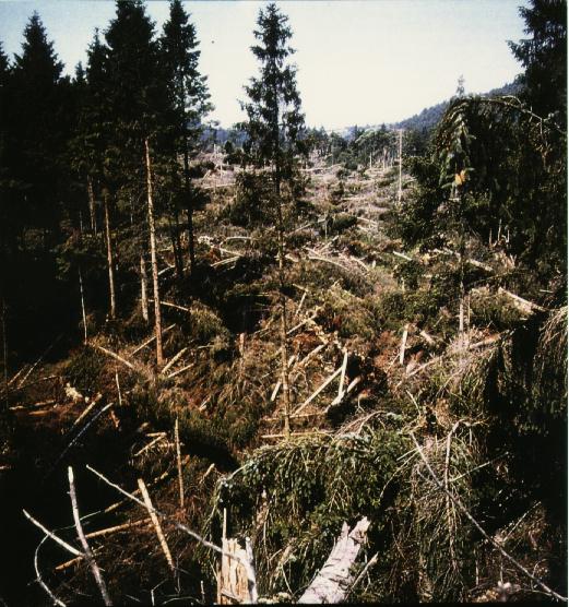
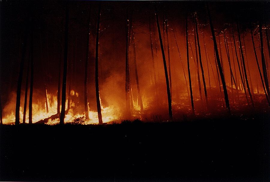
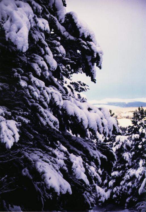
Forest damage by wind, snow and fire is the most serious economic problem facing the forestry sector within the EC. The scale of the problem is enormous costing the EC hundreds of millions of ECU each year. For example, between 1980 and 1988 585000 hectares of forests were burned in member states and in 1990 100 million m3 were blown down in a storm on a single night! Snow damage too accounts for an estimated 4 million m3 every year.
Reducing this huge problem largely depends on foresters making appropriate silvicultural decisions in forests and forest stands to minimize the risk of damage. The main problem is that the silvicultural knowledge needed to make these decisions is generally not available at stand level - the basic management unit in forestry practice.
Current approaches are either at a single tree level or generalized at national level. It is the aim of this project to determine the knowledge needed by foresters at stand level to make silvicultural decisions in relation to the risk of damage. This will be acheived by pooling the knowledge and experience of groups working on single tree and regional studies, to develop a modelling system for use by foresters throughout Europe to aid management decisions as thinning, clear felling and fire hazard fuel clearance while maintaining wood quantity and quality.
The first part of the project concentrates on technical studies into stem, root and branch resistance to wind and snow damage, and into ground cover accumulations in terms of fire risk. The emphasis in the second part is on the use of silvicultural models for the amelioration of damage and the formulation of generic modelling tools for a prototype Geographic Information System (GIS) for planning longer term risk assessments.
The project comprises 8 Tasks.
- Task 1:
- A short programme planning stage to formalize information transfers between participants and structure the common data access. It is structured to produce both project management information and organization of the information system.
- Task 2:
- Calculate from observations on single trees, and their stem and crown physical characteristics, the stress caused by the wind on the tree and the ability of the tree to withstand it.
- Task 3:
- Quantify the resistance of trees to overturning and susceptibility to fire and the mechanisms of wind- and fire induced damage in forests.
- Task 4:
- Use the results of this field and modelling work, to develop approaches to predict under what circumstances damage will occur at the stand level.
- Task 5:
- Apply Task 4 to assemblages of trees resulting from different silvicultural practices.
- Task 6:
- Carry out a vulnerability assessment using outputs from completed Tasks of the risks at a regional or national level using remotely sensed data and GIS.
- Task 7:
- Evaluate the models, and test their applicability using sites in southern and north western Europe.
- Task 8:
- Dissemination of findings and information about project.
A theme of Scale (appropriate to processes, pattern, models, data and analysis) will run throughout the project Tasks, which will be treated as a distinct characteristic of the proposed project. Data output will also be in digital form appropriate for incorporation into the EUROSTAT database of the European environment
| Objective | Participants | Photo Gallery | WWW resources | PROJECT home page |
Alistair Law - a.law@macaulay.ac.uk
Last modified: Mon Jul 1 13:38:35 BST 1996